In a country where addresses can range from detailed street names to vague landmarks like “near the banyan tree”, identifying exact locations has long been a logistical challenge. That challenge may now have met its match in DIGIPIN—a digital addressing system launched by India Post to bring precision and inclusivity to the nation’s postal and emergency services.
The new system assigns a unique 10-character alphanumeric code to every 4-metre by 4-metre grid across India, offering a location-specific identifier far more accurate than traditional postal PIN codes.
Geocoded precision, developed by India’s best
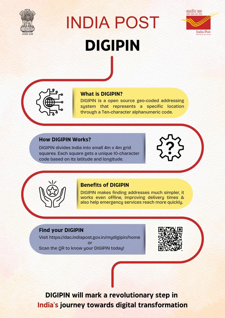
DIGIPIN is a nationwide geocoded addressing system, developed jointly by the Department of Posts, IIT Hyderabad, and NRSC (ISRO). The code is derived from latitude and longitude coordinates, offering standardised, machine-readable digital addresses with approximately four-metre precision.
According to the Department of Posts, “DIGIPIN is an open-source nationwide geocoded addressing system developed by the Department of Posts in collaboration with IIT Hyderabad and NRSC, ISRO. It divides India into approximately 4m x 4m grids (homes, offices, organisations, etc.) and assigns each grid a unique 10-character alphanumeric code based on latitude and longitude coordinates.”
Users can generate their DIGIPIN by visiting the government website https://dac.indiapost.gov.in/mydigipin/home locating their property, and retrieving the code instantly. The logic and programming code for DIGIPIN have been shared in the public domain, enabling both online and offline functionality.
Also read: Dept of Posts to go digital, says Scindia
Complementary, not compulsory
DIGIPIN is not a replacement for your existing postal address, but rather an additional digital layer that enhances its accuracy and usability.
“DIGIPIN is an additional layer of digital addressing that complements the existing system for more precise and standardised location identification. But as the DIGIPIN ecosystem expands into more sectors and is integrated with more GIS systems, the need for providing a descriptive postal address to service agencies for availing any service may reduce,” India Post clarified.
While a traditional address may rely on street names, house numbers or local identifiers, DIGIPIN uses geospatial coordinates to eliminate ambiguity, especially in areas with no structured address system, such as rural or tribal zones, coastal settlements, and forested regions.
E-commerce, emergency response, and more
The new digital code system is set to transform deliveries, particularly for e-commerce platforms like Amazon and Flipkart, which often face challenges in locating remote or poorly marked homes.
Beyond consumer convenience, emergency services such as ambulance dispatch and fire rescue stand to gain immensely from this precise location mapping.
India Post noted, “DIGIPIN simplifies address management by providing precise location-based identification, especially in areas with unstructured or changing addresses. It also helps in areas where no clear address exists, such as rural regions, forests, and oceans.”
Crucially, privacy remains protected—no personal data is stored in the generation or use of DIGIPIN.
As India moves towards a more integrated digital infrastructure, DIGIPIN offers a foundational tool to unify spatial identity across regions and demographics.
Users can already share their DIGIPIN with online merchants, logistics firms, and service providers to ensure faster, error-free deliveries. In remote villages and congested cities alike, the shift from descriptive addresses to precise geocoded tags may soon become the norm rather than the novelty.
“It is particularly useful in creating geo-referenced landmarks in rural or underdeveloped areas where traditional addressing systems may not be well-defined,” the department added.
As the system continues to scale, it could significantly reduce the need for descriptive addresses, bringing India's postal identity firmly into the digital age.

