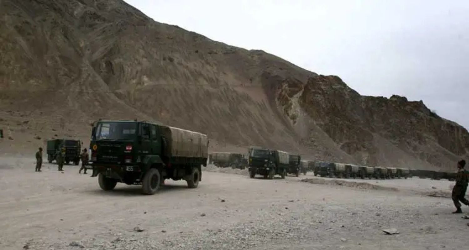
India is strengthening the entire 255-kilometer Darbuk-Shyok-Daulat Beg Oldie (DS-DBO) road in Ladakh to "class 70" standards as part of a significant strategic infrastructure upgrade. For military logistics and national security, particularly in light of the ongoing tensions with China, the route—which passes through the treeless, desolate Karakoram mountain range—is essential.
Heavy military vehicles up to 70 tonnes in weight will be able to travel on the road once it has been upgraded, including all 37 bridges along the route. This greatly improves the Army's mobility in the area and includes tank transporters and missile-carrier trucks.
The DS-DBO road is India's only land access to the Galwan Valley, where Indian and Chinese troops clashed violently in June 2020. It also serves as a lifeline to Daulat Beg Oldie, located near the 17,000-foot-high Karakoram Pass, which separates India’s Ladakh region from China’s Xinjiang province. East of DBO lie the strategically critical Depsang Plains, where Indian and Chinese forces were engaged in a prolonged standoff from May 2020 until October 2024. The region north of the Shyok River is referred to by the Indian Army as the “Sub Sector North” (SSN).
Indian military planners have anticipated scenarios in which China's People’s Liberation Army (PLA) might attempt a westward push into the high-altitude Depsang Plains. Access to the Karakoram Pass and the DS-DBO road may be threatened and cut off by such a move. The DS-DBO route is essential to maintaining troops and equipment in the area because the Indian Army's fortified defensive positions in the SSN are built especially to withstand such situations.
Also Read: ‘India’s cybersecurity needs fully homegrown tech’
Since the standoff started in May 2020, thousands of Chinese and Indian soldiers have continued to be stationed along their respective sides of the Line of Actual Control (LAC). The DS-DBO road is essential to the strategic imperative of retaining control over the SSN.
To reduce reliance on a single access route, India is also constructing an alternative alignment — the Leh-Saser La-Murgo-DBO axis — which is expected to be operational by next year. This alternate route has the added advantage of not being visible to Chinese patrols stationed near the LAC.
As part of this alternate corridor, the Border Roads Organisation (BRO) is building a 4-km-long concrete stretch near the Saser La pass, situated at an altitude of 17,800 feet in the Karakoram. This segment is part of a 56-km military-grade road connecting Sasoma, Saser La, and Murgo, where it links with the existing DS-DBO road.
Also Read: X outage: Musk blames massive cyberattack
At the height of the India-China standoff, in August 2020, the Sasoma-Murgo route was first opened. The Border Roads Organisation (BRO) has been gradually expanding the track since it was activated during the 2020 standoff in order to make it more dependable and accessible for military use. The road's path through 55 hectares of the delicate Karakoram Wildlife Sanctuary was approved by the National Board for Wildlife in 2022, enabling construction to proceed while taking environmental concerns into account.
When taken as a whole, these infrastructure improvements represent a major advancement in strengthening India's strategic position along its disputed border with China. India is enhancing its capacity to react quickly and efficiently in a high-stakes situation by increasing troop mobility, facilitating quicker reinforcements, and bolstering readiness in one of the most difficult terrains in the world.
Also Read: Gov fighting ‘China-linked’ cyberattack: Singapore Defense Min

