After a slow, uneven and below-normal start, the southwest monsoon has staged a strong revival, pushing the country into an overall rainfall surplus during the first week of July and significantly improving the seasonal outlook.
According to the latest data released by the India Meteorological Department (IMD), India received 53.3 mm of rainfall between July 1 and July 6 against the normal average of 48 mm, registering an overall surplus of 11 per cent.
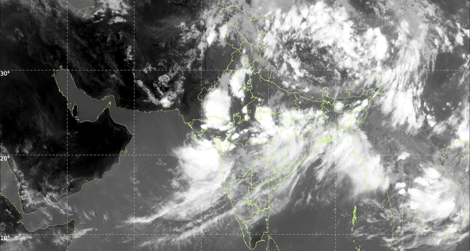
Satellite imagery captured by ISRO's INSAT-3DS satellite highlights the dramatic turnaround, showing thick bands of monsoon clouds spread across almost the entire country. From the Arabian Sea and the Bay of Bengal to the Himalayan foothills, multiple active weather systems are influencing the subcontinent simultaneously, bringing widespread rainfall to large parts of India after a subdued June.
Meteorologists have attributed the active monsoon phase to the combined influence of an active Monsoon Trough, a Monsoon Trough Cyclone (MTC) over western India and a depression over the Bay of Bengal. Together, these weather systems have reinvigorated the southwest monsoon after June witnessed one of its weakest starts in several decades.
The IMD has issued a warning of very heavy rainfall over Odisha, Chhattisgarh and eastern Madhya Pradesh during the next 36 to 48 hours as the Bay of Bengal depression gradually moves inland.
The weather system is expected to bring intense rainfall across eastern and central India, raising the possibility of waterlogging, flash floods, overflowing rivers and disruption to normal life in vulnerable districts.
The depression is also likely to sustain widespread thunderstorms accompanied by heavy to very heavy rainfall over eastern India, while its interaction with the monsoon trough is expected to strengthen rainfall activity across adjoining central regions.
Meanwhile, Mumbai, which has already experienced several days of persistent rain, is likely to witness light to moderate showers during the morning, with rainfall intensity expected to increase considerably after noon.
Meteorologists said abundant moisture from the Arabian Sea, supported by the active monsoon circulation over western India, is likely to trigger another spell of heavy rainfall over Mumbai, neighbouring districts and large parts of the Konkan coast.
Also read: 13 dead as Maharashtra rains batter Mumbai, Pune
Western India continues to remain under the influence of the Monsoon Trough Cyclone, resulting in widespread rainfall across Gujarat, Maharashtra and adjoining areas. At the same time, northern India is receiving rain under the influence of the active monsoon trough extending across the Indo-Gangetic plains.
The Bay of Bengal depression continues to remain the primary driver of thunderstorms and widespread rainfall across Odisha and neighbouring eastern states, with its influence expected to extend further inland over the next couple of days.
The latest rainfall distribution map reflects the sharp improvement in monsoon activity. Gujarat, Maharashtra, Odisha, Chhattisgarh, Madhya Pradesh and the Andaman and Nicobar Islands have all recorded excess to large excess rainfall over the past week.
Rainfall deficiencies, however, persist over parts of Uttar Pradesh, West Bengal, Bihar and sections of the Northeast. Forecasters believe these deficits could narrow considerably if the present active monsoon phase continues over the coming days.
With rain-bearing cloud systems now covering almost the entire country, weather experts expect the southwest monsoon to remain active and vigorous in the near term.
The widespread rainfall is expected to significantly benefit the ongoing kharif sowing season, improve water storage in reservoirs, recharge groundwater and ease concerns that had emerged after the delayed onset and weak performance of the monsoon through much of June.

 Follow us